Detail Garmin GPSMap 62ST
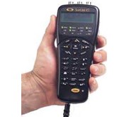
Garmin GPSMap 62ST
When the terrain gets tough, you can depend on the GPSMAP 62st handheld navigator to guide you through. Inspired by the powerful GPSMAP 60 series, this rugged and waterproof GPS combines high-precision accuracy with high functionality to brave the demands of any terrain you dare to tackle – wherever the adventure, whatever the activity.
Its tilt-compensated 3-axis compass helps you get your orientation and points you towards your destination even when you' re standing still or not holding the navigator flat, whilst the barometric altimeter enables you to track changes in atmospheric atmosphere to pinpoint your exact altitude. View elevation and profile on the altimeter screen and plot barometric pressure over time to keep an eye on changing weather conditions. GPSMAP 62st features a 2.6-inch sunlight-readable colour screen with built-in European recreation map showing street level detail ( approx 1: 100, 000 scale) , so you can navigate anywhere with ease. With photo navigation, you can download pictures from Garmin Connect Photos and navigate straight to the scene.
Keep Your Fix
With a quad helix antenna and high-sensitivity, WAAS/ EGNOS-enabled GPS receiver with HotFix satellite prediction, GPSMAP 62st has unparalleled reception to locate your position quickly and precisely and maintains its GPS location even in heavy cover and deep valleys. The advantage is clear - whether you' re in deep woods or just near tall buildings and trees, you can count on GPSMAP 62st to help you find your way when you need it the most.
Enhance Your Adventures
With space to store up to 2000 waypoints and 200 routes, GPSMAP 62st' s detailed route planning and tracking helps you navigate from point-to-point and keep track of your journey as you go. As you navigate to a destination on an active track, you can view upcoming elevation changes together with waypoints and key stages along the route for a clear picture of the journey ahead. And with customisable display, you can tailor GPSMAP 62st' s dashboard to show you the details you need on your adventure. You can also share your routes, tracks, waypoints and geocaches wirelessly with compatible Garmin GPS handhelds.
Adventure Further
Adding more maps is easy with Garmin' s wide array of detailed topographic, marine and road maps, which can be loaded to internal memory. Your GPSMAP 62st is also compatible with BirdsEye satellite imagery which allows you to see the terrain in terrific clarity and high resolution detail ( quality and coverage varied worldwide) .
Find Fun
GPSMAP 62st supports geocaching GPX files for downloading geocaches and details straight to your unit. By going paperless, you' re not only helping the environment but saving time you would otherwise waste manually entering cache details before you set off. GPSMAP 62st stores and displays key information, including location, terrain, difficulty, hints and descriptions, which means no more manually entering coordinates or paper print outs! Simply upload the GPX file to your unit and start hunting for caches. Slim and lightweight, GPSMAP 62st is the perfect companion for all your outdoor pursuits.
Get Connected
You' ve been busy exploring and now you want to store, save and share your routes, tracks and waypoints. With a simple connection to your computer and to the Internet, you can get a detailed analysis of your activities and send tracks to your outdoor device using Garmin Connect, Garmin' s free worldwide online community.
Simply upload activities saved on GPSMAP 62st from your hiking, camping or geocaching adventure to keep a record on the web or swap ideas and expeditions with others. This one-stop-site offers an activity table and allows you to view your activities on a map using Google Earth. Explore other routes uploaded by millions of Garmin Connect users and share your experiences on Twitter and Facebook.
• Robust, waterproof navigator with built-in high sensitivity GPS and European recreation map
• Space to store up to 2000 waypoints and 200 routes plus expandable memory
• Tilt-compensated 3-axis compass shows your heading even when standing still or unit not held flat
• Barometric altimeter plots elevation and profile and tracks atmospheric pressure to pinpoint your precise altitude
• Download geocache descriptions, locations and hints for paperless geocaching
Box Contains
• GPSMAP 62st
• Wrist strap
• USB cable
• Quick start manual
Tampilkan Lebih Banyak